When to imagine it
Late spring through early autumn is an editorial starting point. Rain, wind and mountain conditions can change any day.
Suggested months: November, December, January, February, March. Weather is never guaranteed.
The Hidden Romance Collection · New Zealand
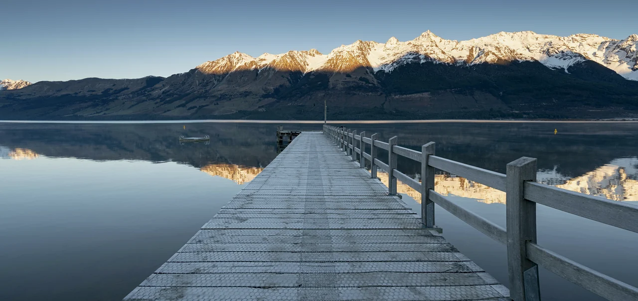
Jamie Wang · CC BY-SA 2.0. Landscape reference, not a commissioned portrait. Image resized; display crop may vary. Photograph retains its source license.
Walk to the foreshore together and make a photograph with the mountains beyond the lake.
A wharf reaching toward mountains, a wetland walk, and a lake that invites a slower pace. Come for the landscape; leave space for the conversation.
Editorial destination guide · reviewed 2026-10-25. Check current conditions with the linked official sources before booking.
Find a place for your moment ↓Late spring through early autumn is an editorial starting point. Rain, wind and mountain conditions can change any day.
Suggested months: November, December, January, February, March. Weather is never guaranteed.
Glenorchy suits a slower stay; Queenstown is a separate base requiring a road transfer.
Plan meals in town and confirm opening directly; do not assume late service after a photo outing.
The wharf is a shared visitor stop. Choose a foreshore alternative if it is crowded or unsuitable.
Boardwalk and foreshore surfaces differ. Lagoon sections can flood; check the DOC notice before setting out.
Perfect Photo Spot Cards
A familiar lakeside landmark facing the mountain landscape.
Use a foreshore position that keeps both of you away from the edge; allow the jetty to guide the eye.
Check conditions and share the space; the wharf is not private.
An alternative lake-edge composition near the town.
Try a walking embrace with a wide landscape behind you; keep the phone safely above splash level.
Use established public access and avoid unstable water edges.
A wetland walk with birdlife and changing reflections.
Photograph from the boardwalk without spreading equipment across the route; let the reeds frame the scene.
Check DOC flood notices and keep to the formed route.
Photo directions are suggestions, not a promise of the same image or permission to stage a session. Stay on permitted paths and yield to other visitors.
Approximate planning pin. Verify the entrance and permitted route before traveling. Map: © OpenStreetMap contributors. Opening the embedded map sends a request to OpenStreetMap.
Open Glenorchy Wharf in maps ↗The Perfect Moment Studio
A date. A real place. A little more room for a beautiful photograph.
All times use the destination’s local time zone: Pacific/Auckland. These are astronomical planning estimates, not a weather forecast.
For a gentle portrait, turn toward soft light from the side. For a silhouette, place the bright sky behind you and lower exposure. Mountains and buildings may hide the sun well before the calculated sunset.
Arrive at least 20 minutes early, with additional time for safe access and any venue restrictions. Location: -44.8509, 168.3815.
Make it yours
A steady phone. A little space. Something to say to each other. Start with that.
The reveal-note tool runs only in this page. It does not contact your partner or save a private account.
Reviewed 2026-10-25. Conditions, schedules and permissions may change.